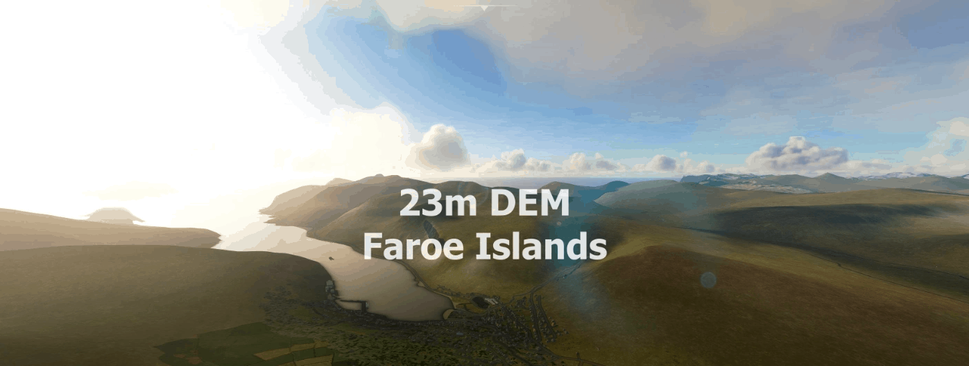
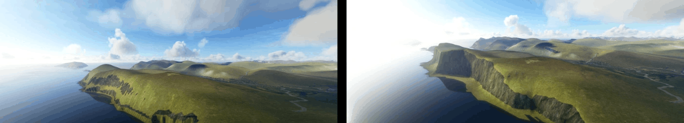
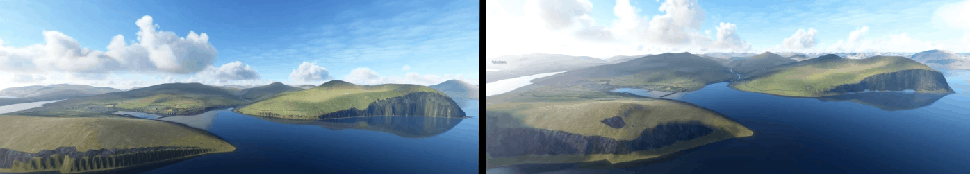
Faroe Islands 23m DEM – High Resolution Terrain Elevation Data from SRTM Arc 1″ v1.0
Experience the Faroe Islands
This mod contains customized height profiles. The mod contains high definition SRTM DEM data with a mesh resolution of 23m.
IMPORTANT
Disclaimer: The creator of this mod is not responsible for any problems, damage, incompatibilites to other mods or performance issues that might occur.
Please note, that this mod is a very high resolution mesh. The elevation data is applied through terraforming rectangles, thus loaded at a certain distance from the player. When travelling fast or at high alitude (wide range of view) there might be too many new rectangles loaded simultaneously and thus stutters might occur.
If you have any stutters you can try and reduce your ingame render settings or uninstall!
If you are mainly flying airliners in high altitude, there is probably no benefit for you in using this mod.
Credits
The elevation data used was a SRTM 23m height profile (http://www.viewfinderpanoramas.org/dem3.html)
It was then transfered into MSFS using MSFS Toolkit by Nool Aerosystems (https://msfs.nool.ee/)
Thank you both and for anyone reading this: Please go ahead and support them!
Thanks Troglodytus for you help!
Enjoy your VFR flights above the Faroe Islands!
Known issues
the free available Vagar Airport is a little bit crazy, i am contacting the author maybe we can fix that.